Bukit Keledang 803m with stunning views of Kinta Valley and an invigorating workout!
- Gypsytracker
- Oct 10, 2024
- 4 min read
Updated: Oct 11, 2024
Bukit Keledang, standing at 808 meters, is a forested hill overlooking the Kinta Valley in the town of Menglembu, famous for its groundnuts. Unlike the nearby limestone hills surrounding Ipoh, Bukit Keledang is a granite hill within the Keledang range.
Hiking up Bukit Keledang offers expansive views of the Titiwangsa range in the opposite direction and Ipoh town. At the peak, you'll find numerous transmission towers. Local residents recall that during the colonial period, the hill was fenced off and guarded by soldiers, likely for strategic military communication. Today, it’s a popular spot for hiking for beginners and seasoned hikers alike. #bukitkeledang
If you are in Ipoh for a "cuti-cuti Malaysia" visit and feel like you have eaten too much and wish to sweat out some of the calories in order to eat more, and have 4 hours to spare, Bukit Keledang is the best choice! There are several trails to choose from and if you are pressing for time, a hike up to the look-out point is rewarding enough!

Starting point: Park at the road shoulder
Hike Duration: 4 hours
End Hike: Multiple trails
Hike Difficulty: 3/5, don't under-estimate this one!
Toilet facilities: none
Main trails on the hill
RTM
4-2
4-9
Note: if you are used to hikes in Gasing or Kiara, this hill is more demanding. Make sure you prepare more water. Be prepared for a grueling workout! According to the locals,
4-2, 4-9 are the distance of the trail respectively. If you are taking RTM trail back, it can be hot as the trail is unshaded!
What to bring
1. Basic first aid stuff such as disinfectant, ankle guard in case you sprain your ankle, band-aid.
2. Raincoat and Poncho,
3. At least 1l of water
4. Good pair of hiking shoes
5. Cap
Trail RTM
When you park at the foot of Bukit Keledang, begin by walking pass the fruit store and head up the tarmac road. The ascent is straightforward, gently winding through a series of bends as you climb the hill. Along the way, a few gazebos offer perfect spots to rest, catch your breath, and take in the view of the city below.
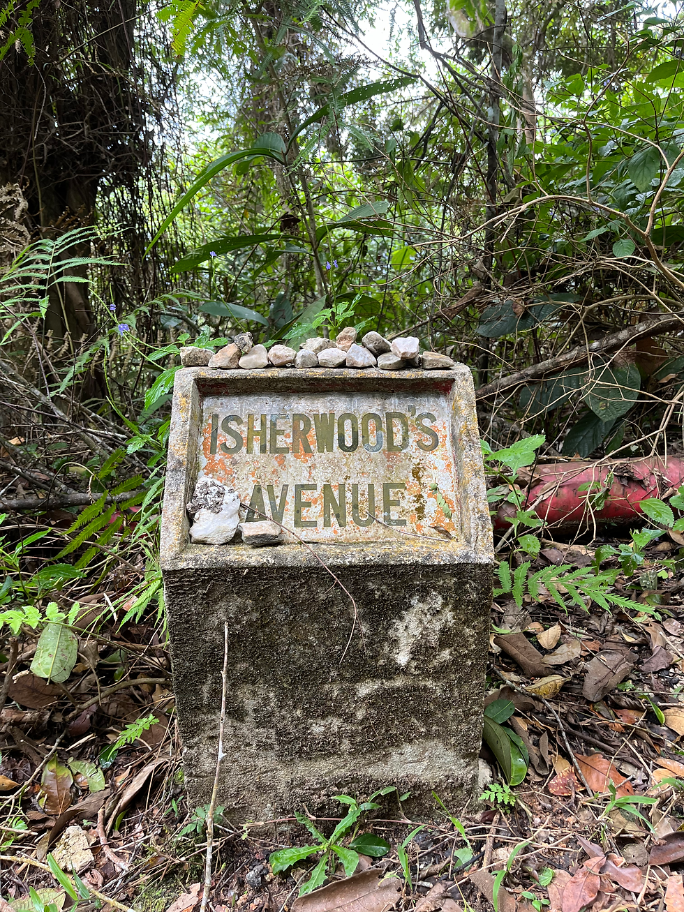
By the side of the road, you'll notice colonial-era mile markers with intriguing names, remnants of a bygone era. It's said that Bukit Keledang, much like Bukit Kutu in KKB, was once a retreat for British officials escaping the oppressive heat.
According to locals, there were several notable milestones like Peck's Progress, Sly Corner, and Spooner's Rest, but these markers seem to have disappeared post-COVID. Each of these milestones likely carried a deeper significance, now lost to time and the elements.
It's possible that this hill, now mainly known for its transmission tower, served a more meaningful role in the past, holding stories and memories that have since faded. #bukitkutu

After about a 2-hour hike, you will reach approximately 803 meters. The temperature at the peak is noticeably cooler. Though there are no panoramic views from the top, if you're fortunate, you may witness blankets of clouds rolling in, creating a mystical atmosphere.

We didn't take the RTM trail to the top; instead, we followed trails 4-9, which merge with another path leading to the peak. This route winds through a shaded canopy, passing streams, waterfalls, towering trees, and seasonal flowers and mushrooms, making for a scenic forest hike.
The terrain was a consistent upward climb, offering little in the way of flat or undulating sections. If you’re aiming for the peak, be prepared for a challenging workout. It’s essential to time your hike properly to avoid finishing in the dark.
Trail 4-9
When you park at the foot of Bukit Keledang, instead of taking the direct tarmac road near RTM, we opted for the forest path. Following markers 4-9, we eventually reached the cascading waterfalls. The hike through this trail is scenic, winding through the forest with some gigantic trees towering overhead. A gentle, gurgling stream runs along the trail, offering a soothing distraction as you make the moderate ascent.

From the waterfall, we took the left path that leads to the peak. This section of the hike becomes more challenging, with steep gradients and few flat areas to rest. The incline is steady and demanding, so be prepared for a tough 1.5-kilometer ascent to the summit.

Trail 4-2
The ascent takes you through a flight of old tire steps and dense thickets of 'resam' ferns, with monkey pitcher plants (Nepenthes) creeping everywhere. #nepenthes
Though the trail offers little shade, as a Nepenthes enthusiast, it felt like stepping into a wonderland. These lowland species were thriving, showcasing a variety of shapes and colors. It was a joy to carefully lift the leaves and discover smaller, hidden varieties tucked away from plain sight, adding an extra layer of excitement for plant lovers.


REFLECTIONS
The Bukit Kledang hike turned out to be far more challenging than expected! We initially underestimated the difficulty, thinking it would be an easy climb, but it required much more effort than we anticipated.
The rewards, however, were well worth it. The views were absolutely breathtaking, with many vantage points along the way, and we even spotted some wildlife. Seeing the Kinta Valley and Ipoh from such a different perspective was truly a highlight of the experience! ..... and the various nepenthes too!

Date visited: 21 September 2024


コメント